Multi-Use Trail in Far North Dallas
Get in touchThe Preston Ridge Trail – where the community connects
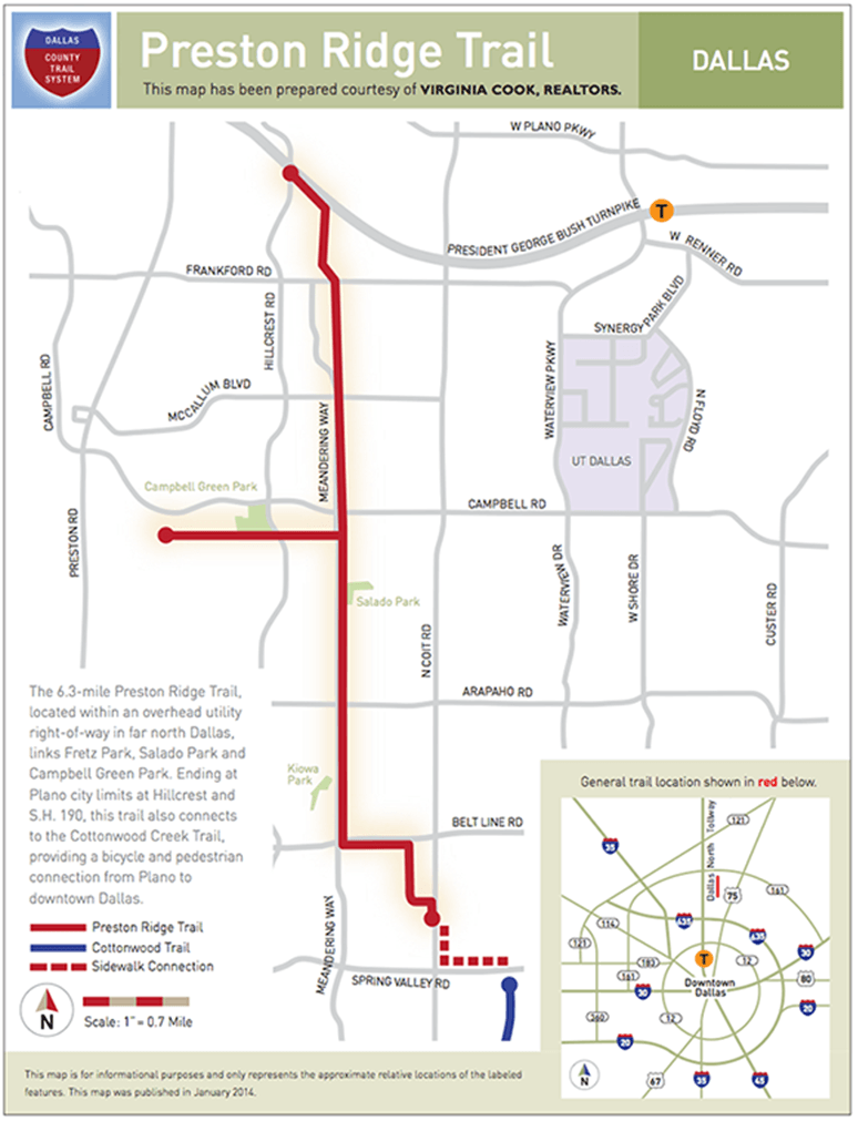
Here in Dallas, TX, we have a unique asset that can be enjoyed by people of all ages and fitness levels. The Preston Ridge Trail is a 6.3-mile multi-use trail that connects Dallas, TX, with Plano, TX, within an overhead utility right-of-way. Ideal for walkers, joggers, cyclists, and skaters, this fully-paved trail links Fretz Park, Salado Park, and Campbell Green Park. During the spring months, crape myrtle trees and seasonal wildflowers sport radiant blooms, and the trail is clean and well-groomed year-round due to the hard work of dedicated volunteers. The Friends of Preston Ridge Trail invite you to enjoy this wonderful resource with your family and friends, and to be a part of its ongoing conservation.
How to get there
The current alignment of the Preston Ridge Trail begins near the intersection of Spring Valley and Coit, on the north side of Spring Valley. It runs north, primarily along Meandering Way, and ends at Highway 190 and Collin County.
How you can help
There are many ways you can help The Friends of Preston Ridge Trail keep the trail clean, safe, and attractive for future users. Visit our Projects page to learn about upcoming and ongoing construction or landscaping needs. You can also click on our Brick Paver page for information on how you can immortalize your family or business name in stone, right here on the trail. Or, simply talk to a member of The Friends of Preston Ridge Trail in Dallas, TX. We welcome your ideas and contributions!


